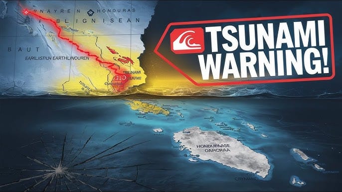
A 7.6 magnitude earthquake struck the Caribbean, shaking several islands and triggering concerns about a possible tsunami warning for the US coast. Residents in affected areas reported powerful tremors, and local governments issued alerts urging caution. Given the history of seismic activity in this region, people are wondering: Is the US at risk of a tsunami?
Seismic events of this magnitude can have far-reaching effects. The Caribbean sits on multiple tectonic plate boundaries, making it vulnerable to strong earthquakes and potential tsunamis. In this article, we will analyze the earthquake’s impact, tsunami risk, past occurrences, and emergency preparedness measures.
Understanding the 7.6 Magnitude Caribbean Earthquake
Was There a Tsunami Warning Issued?
Immediately after the earthquake, the Pacific Tsunami Warning Center (PTWC) and the U.S. Geological Survey (USGS) analyzed the data to determine if a tsunami warning for the US coast was necessary. While initial tsunami watches were issued for some Caribbean nations, further analysis revealed no significant tsunami risk for the mainland US.
What is a 7.6 Magnitude Earthquake?

Earthquakes are measured on the Richter scale or Moment Magnitude Scale (Mw), with magnitudes above 7.0 classified as major earthquakes. It releases immense energy, capable of causing widespread destruction, ground shaking, and potential secondary hazards like tsunamis.
To put this into perspective, a 7.6 magnitude earthquake releases energy equivalent to multiple atomic bombs, making it a significant seismic event. The force of such an earthquake is strong enough to shift the Earth’s crust, disrupt geological formations, and trigger landslides or ground ruptures.
Where Did the Earthquake Strike?
The epicenter of the earthquake was located in the Caribbean Sea, affecting countries such as Puerto Rico, the Dominican Republic, Haiti, and Jamaica. The tremors were felt as far as Florida and parts of the East Coast of the United States.
The depth of the earthquake, measured by seismologists, plays a crucial role in determining its impact. Shallow earthquakes, typically occurring at depths of less than 70 km, tend to cause more damage than deeper ones. In this case, early reports suggested that the earthquake occurred at a moderate depth, increasing concerns about its potential effects.
Tectonic Activity in the Caribbean Region
The Caribbean region is a seismically active area due to its position at the junction of multiple tectonic plates, including the Caribbean Plate, North American Plate, and South American Plate. These plates are in constant motion, and their interactions can result in seismic activity such as earthquakes and volcanic eruptions.
The subduction zones and transform faults in the region are primary contributors to powerful earthquakes. Historical seismic data indicate that the Caribbean has experienced several major earthquakes over the past centuries.
Why Was This Earthquake So Powerful?

The 7.6 magnitude of this earthquake suggests an event capable of rupturing large fault segments over an extensive area. The release of stress accumulated over centuries within these fault systems resulted in intense shaking, structural damage, and the potential risk of aftershocks.
Seismic waves travel outward from the epicenter, affecting different regions with varying intensities. The Modified Mercalli Intensity (MMI) scale is often used to assess how strongly an earthquake is felt at different locations. Early reports indicate that this earthquake reached MMI levels of VI-VIII in several affected areas, signifying strong to severe shaking.
Impact of the 7.6 Magnitude Earthquake
1. Ground Shaking and Structural Damage
Residents reported intense ground shaking, causing structural damage to buildings, roads, and critical infrastructure. In some areas, buildings collapsed, and power outages were reported due to damaged electrical grids.
2. Potential for Aftershocks
Following a major earthquake, aftershocks are common. These smaller tremors can continue for days or even weeks, posing additional risks to already weakened structures. The USGS and other geological agencies continue to monitor aftershocks in the region.
3. Tsunami Threat Analysis
While the 7.6 magnitude earthquake raised concerns about a possible tsunami, the Pacific Tsunami Warning Center (PTWC) and the U.S. Geological Survey (USGS) quickly analyzed the data. A tsunami occurs when an earthquake causes a sudden displacement of the ocean floor, generating massive waves. However, in this case, the earthquake did not cause significant seafloor displacement, leading experts to determine that no major tsunami threat existed for the US coast.
Comparison with Past Earthquakes
Several powerful earthquakes in the Caribbean have had devastating impacts, including:
- 2010 Haiti Earthquake (Magnitude 7.0): Caused massive destruction and loss of life.
- 1946 Dominican Republic Earthquake: Generated a tsunami that affected Florida.
- 1755 Lisbon Earthquake: Created waves that reached the East Coast of the US.
Although the 7.6 magnitude earthquake was powerful, its characteristics did not align with previous tsunami-triggering events.
Tsunami Risk for the US Coast
How Do Earthquakes Trigger Tsunamis?
A tsunami occurs when an earthquake causes a sudden displacement of the ocean floor, generating massive waves that can travel across the sea at high speeds. The impact of a tsunami depends on factors like depth, location, and the energy released by the quake.
Has the US Experienced Tsunamis from Caribbean Earthquakes Before?
Historically, tsunamis from Caribbean earthquakes have reached the US coast, though their effects have varied:
- The 1946 Dominican Republic Earthquake triggered a tsunami that affected Florida.
- The 1755 Lisbon Earthquake generated waves that reached the East Coast.
Although the recent it was powerful, experts determined that it did not create enough seafloor displacement to pose a major tsunami threat to the US.
Emergency Preparedness and Safety Measures
What Should You Do in Case of a Tsunami Warning?
If a tsunami warning for the US coast is issued, follow these safety tips:
- Move to Higher Ground: Evacuate coastal areas immediately.
- Follow Official Alerts: Pay attention to emergency broadcasts from NOAA, PTWC, and USGS.
- Stay Away from the Shoreline: Tsunami waves can strike in multiple surges.
Is the US Coast Prepared for Tsunamis?

Government agencies continuously monitor seismic activity and have implemented early warning systems along the East Coast, Gulf of Mexico, and West Coast. Coastal communities also conduct tsunami drills to prepare for potential threats.
Should You Be Concerned?
The 7.6 magnitude earthquake that shook the Caribbean was a reminder of how unpredictable seismic activity can be. While no major tsunami threat was issued for the US coast, it highlights the importance of staying informed and prepared.
Understanding earthquake risks, tsunami behavior, and emergency response protocols is crucial for protecting lives and property. Stay tuned to official updates and always be ready for potential natural disasters.
Key Takeaways
- A 7.6 magnitude earthquake struck the Caribbean, causing concern about a tsunami warning for the US coast.
- The USGS and PTWC analyzed the situation and confirmed no major tsunami threat.
- Tsunamis from Caribbean earthquakes have historically affected the US, but this event posed minimal risk.
- Emergency preparedness remains essential, with early warning systems in place along the US coastline.
- Always follow official alerts and be aware of evacuation plans in case of future tsunami warnings.